Search results and exporting information
Image

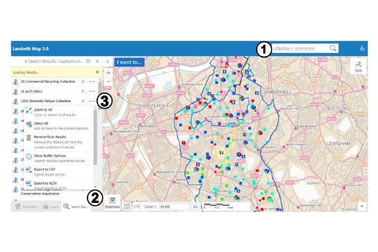
- Search for information in each layer by using the search bar.
- Results are shown in the information panel, with a ‘Search results’ button appearing along the bottom of the panel.
- Each map layer has a spreadsheet of information, which can be downloaded by clicking on the three dots next to the data layer, ‘…’, and choosing ‘export to CSV’.
Individual records
Image

Image

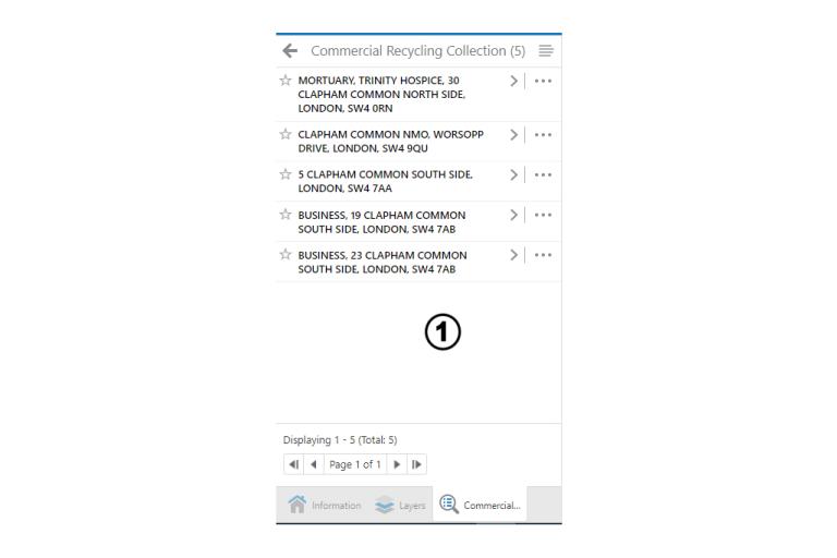
- After you’ve searched, selecting a result will show each individual record.
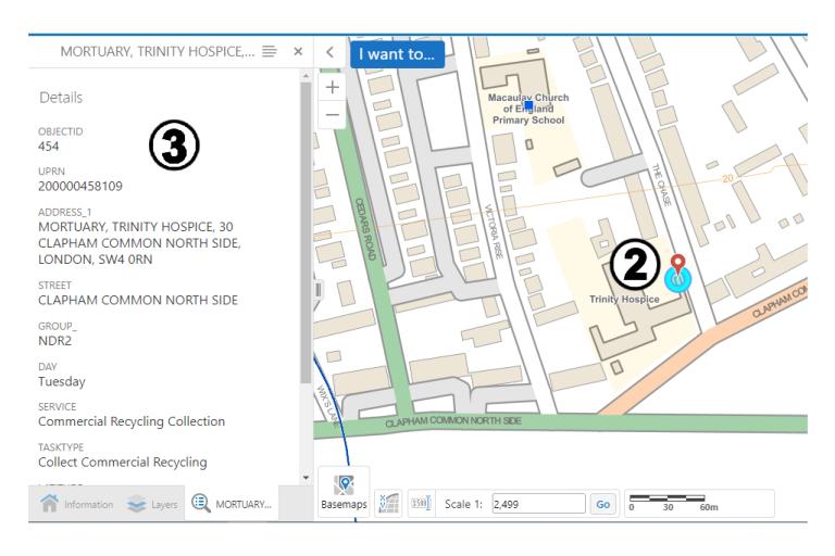
- Clicking a result will show it on the map. If you’re using a mouse, hovering over a search result will also highlight it on the map.
- You’ll also see the detailed data for that individual record.
